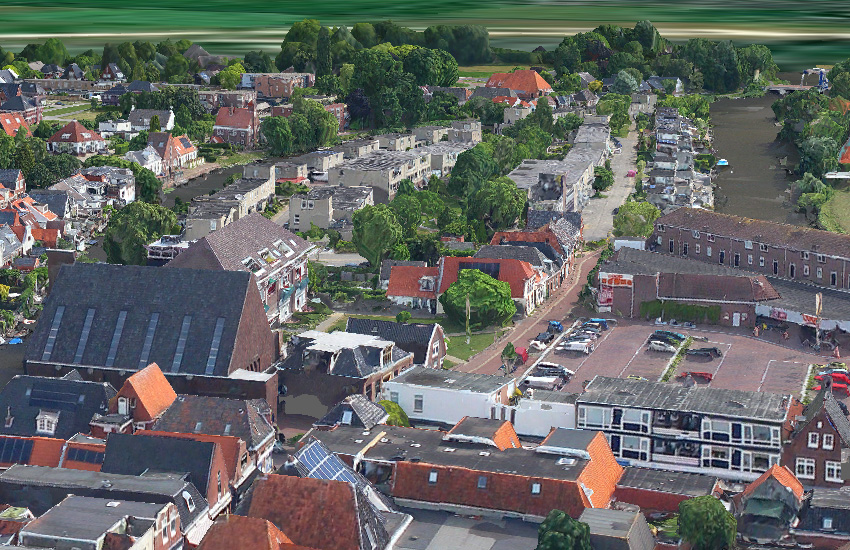
Appingeham, The Netherlands
A few circles over Appingedam, a town in The Netherlands to produce a high res 3D model.
Capture
| Camera Model Aircraft Date Flown Plan Type Plan Resolution Plan Overlap Plan Flying Height Survey Duration Images Captured Area Covered Calculated SQKM/Hour |
XCAM B (RGB/RGB) Cessna F172 27th June 2017 WaldoAir Circular Path 5cm n/a (Circular Path) 1,100 FT AGL 4m 16s 370 0.65 square kilometres 9.13 |
Processing
This circular project was processed in Skyline Photomesh using 5 networked computers (Intel i7 4785T, 16GB RAM, 460GB SSD). They were ‘fused’ together to do the Photo Preparation, Aerotriangulation, Tile Build and Product Output. Ground Control Points (GCPs) were used as they were available for this project area.
| Photo Preparation Aerotriangulation (AT) Tile Build (Point Cloud & Mesh) Product Output |
0h 11m 59s 0h 55m 04s 16h 25m 32s 0h 10m 57s |
Product Showcase


Data Download
- Raw Data (Click here to download)
- Orthophoto ECW Format (Click here to download)
- 3D Viewer Kit Skyline Terra Explorer (Click here to download)
Credits
Data captured by Kavel10. Data can be used for demonstration and evaluation purposes only. Raw or derived data not to be sold.